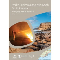
The Flinders Ranges Emergency Services Map Book is a sequel to the Southern Flinders Ranges CFS map book.
This new book offers updated detailed topographic maps providing information about the region including roads and tracks, buildings and many other features in the landscape. In addition to this it contains major improvements including the extension to the map coverage to now take in both the South and North Flinders Ranges. It contains multiple map scales which means that areas with significant detail can be shown in a clear and easy to read format. Many town enlargement maps have also been included in this edition.
Additional features include: street index, suburb and locality index, rural property address numbers, DEWNR Park boundaries, gates and gate numbers
This Map Book is produced to support emergency service operations, but is full of information useful for the general traveller, recreational and commercial users alike.
3rd edition, 2018
Size: 240mm x 325mm, 196 pages, weight 986 grams